Time Synced Precision
Automatically synced to the microsecond through a single topside data stream.
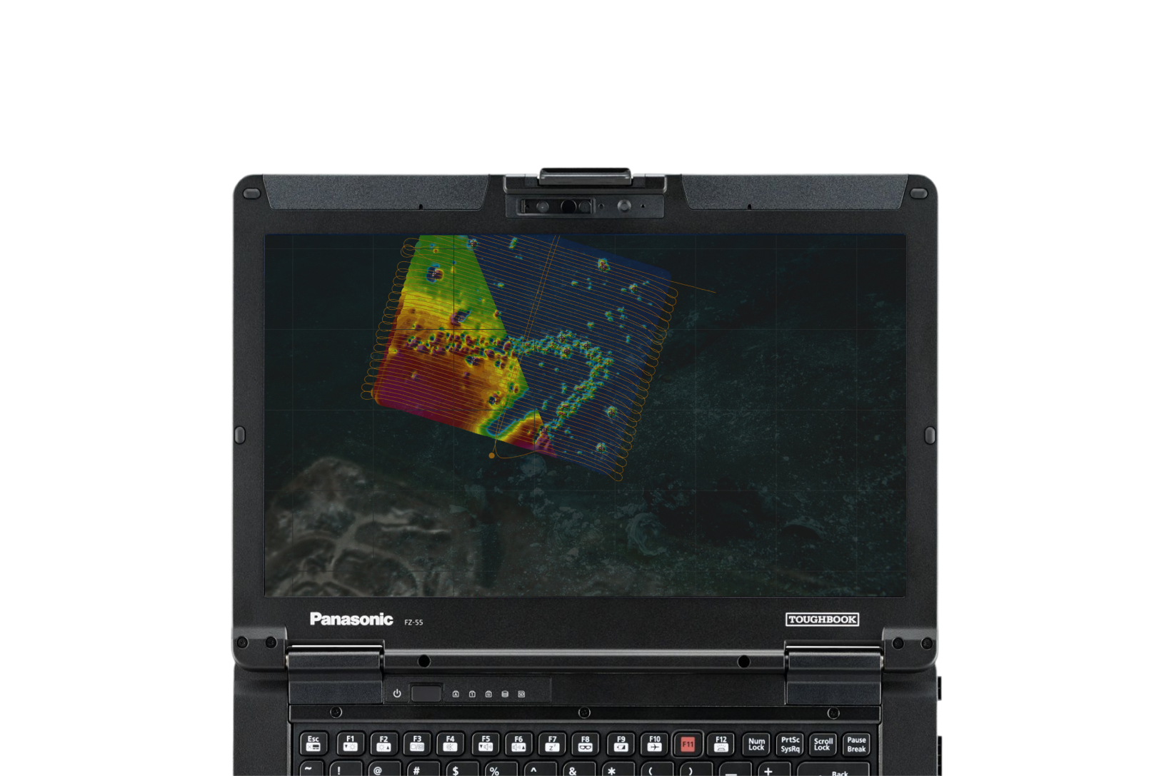
Synchronized Magnetic Gradiometer System
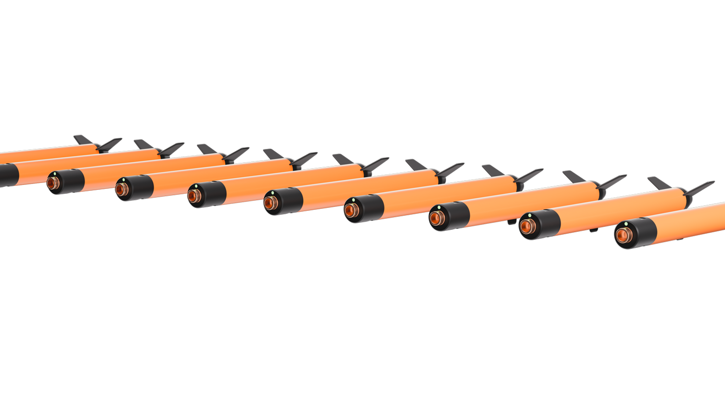
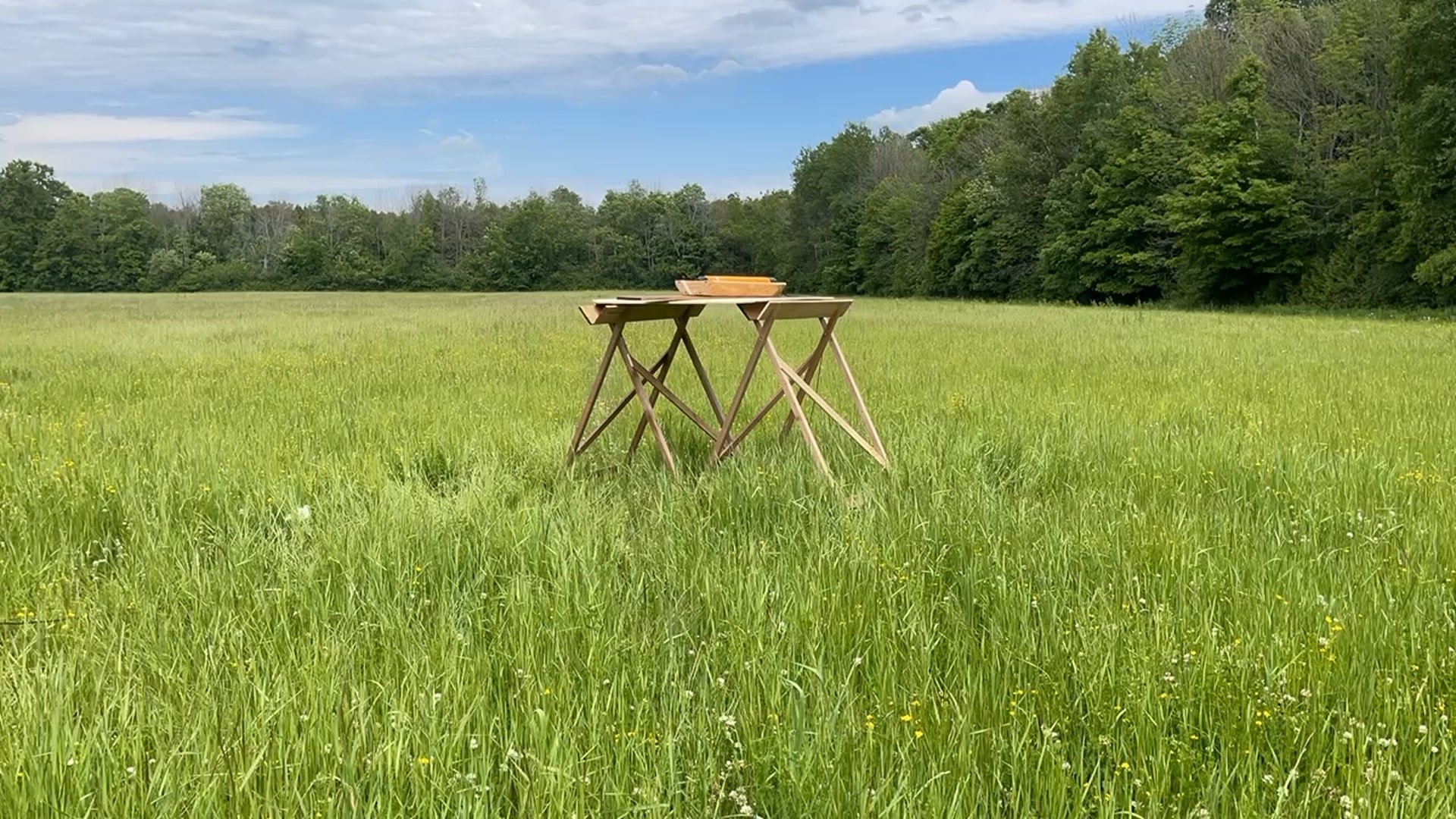
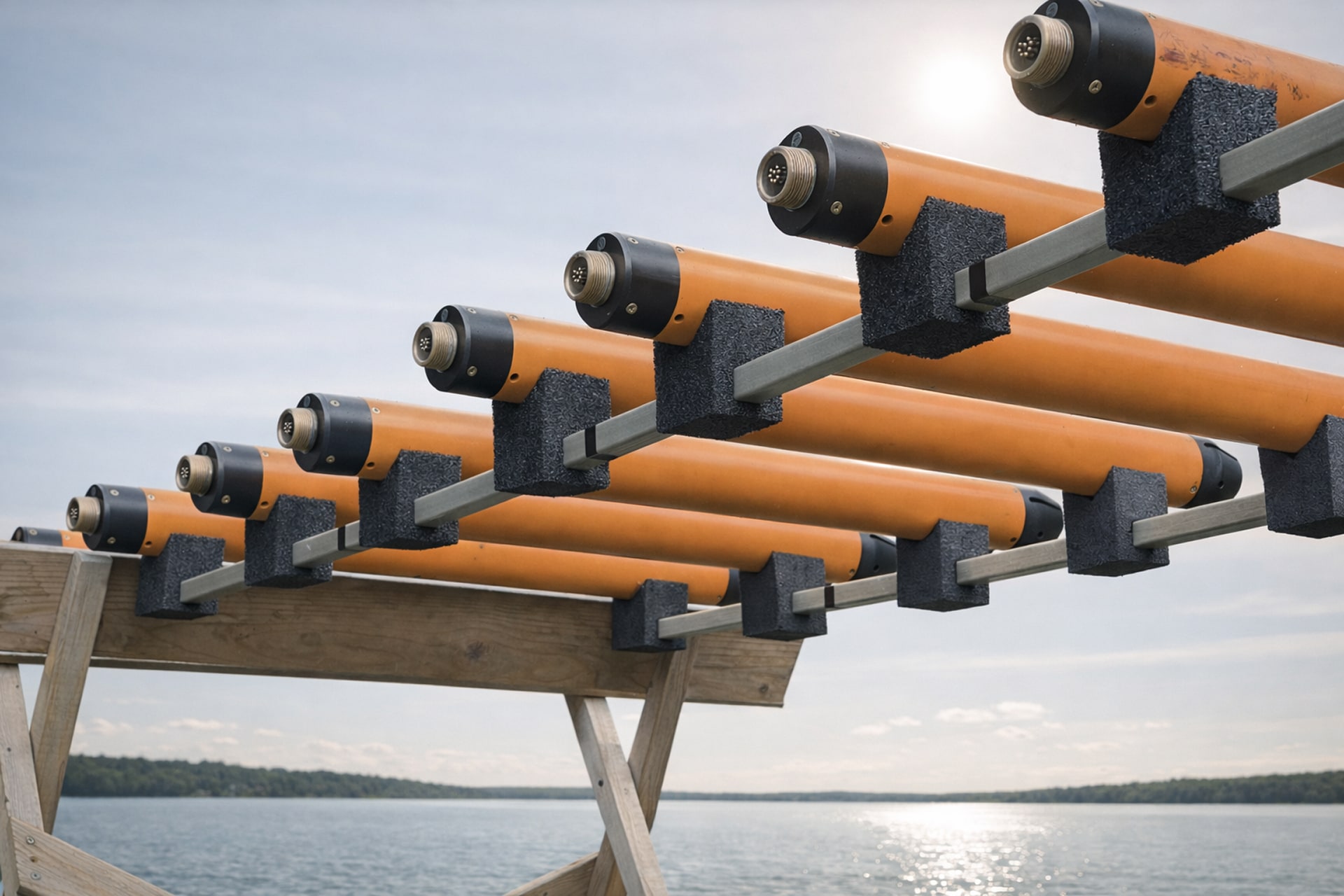
Stockpile a few dozen nodes, grab however many a survey’s parameters may need, connect them and “go.”
Every node is identical and interchangeable. Instead of humans micro-managing sensor relationships, they figure it out independently. One of the sensors takes charge, coordinates data from the network and sends it to the humans topside.
If you add another sensor, the sensor in charge recognizes and integrates the new sensor.
Less downtime can lower on-vessel equipment setup from half a day to half an hour.
Build Quality
Time Synced Precision
Automatically synced to the microsecond through a single topside data stream.
Neutrally-buoyant for any deployment
Conventional or unmanned, above and below the surface.
Integrated Tracking
No messy attachments
Ultra Compact
Smaller sensors can reduce an array’s size and weight by a factor of 4-5.
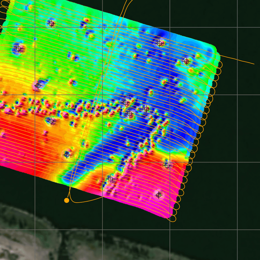
More Definition
Get sharper data with faster sampling rates and tighter survey tracks with more compact mags.
Make Synapse Array a perfect fit for your application.
Size + Weight


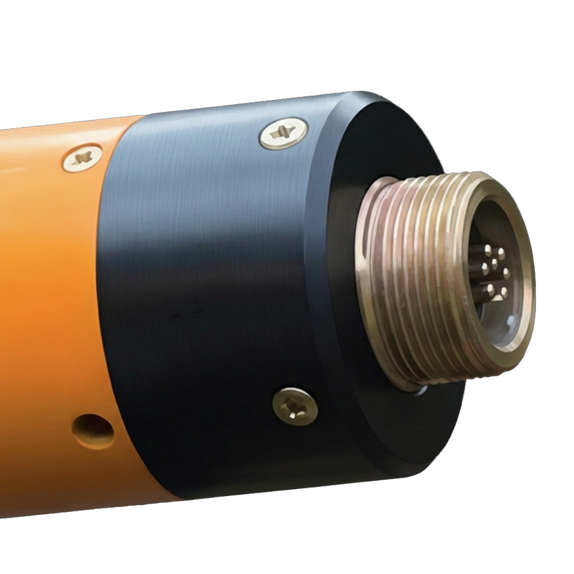
Magnetometer
Length: 89 cm
Diameter: 7.6 cm (tube), 24 cm (fin)
Weight in air: 3.5 kg
Weight in water: Neutral
With Altimeter
Combined length: 94 cm
Combined weight in air: 4.7 kg
Weight in water: Neutral
Sensor Options

Tuned Overhauser for absolute accuracy
(Coming Soon)
Operating Zones: Worldwide
Measurement Type: Scalar
Absolute Accuracy: 0.1 nT
Sensitivity: 0.01 nT (0.02 nT optional)
Counter Sensitivity: 0.001 nT
Resolution: 0.001 nT
Dead Zone: NONE
Heading Error: NONE
Temperature Drift: NONE
Gradient Tolerance: > 10,000 nT/m
Range: 18,000 – 120,000 nT
Sampling Rates: 4 Hz – 0.1 Hz

Rubidium Laser Pumped for rapid sampling
Operating Zones: Worldwide
Measurement Type: Scalar
Absolute Accuracy: TBD
Sensitivity: 0.01 nT
Resolution: 0.001 nT
Dead Zone: 1 Zone (+\- 6° from center) Sensor can be easily rotated for worldwide operation
Gradient Tolerance: > 10,000 nT/m
Range: 18,000 – 120,000 nT
Sampling Rates: up to 20 hz
Operation
Operating Zones: Worldwide
Max Depth Rating: 1000m
Power Consumption: 4.5 W per node 7 W with altimeter and IMU
Power Supply: 24 VDC (120-240 VAC compatible) (Acceptable range 9-30 VDC)
Data
Interface: USB or RS232
Communication: WiFi web interface (access point mode) RS-232, 9600 bps
System
Integrated
Network Status LED
Leak Detector
Optional
Altimeter: Narrow beam 200 kHz, 0.01 m resolution, 100 m range
Tilt IMU: Full Euler-angle attitude solution, 0.01° resolution (pitch, roll, yaw)
Pressure/Depth sensor
Cables

Floatation Tow Cable
Conductors: Twisted pair
Breaking Strength: 2,500 kg
Outer Diameter: 1.9 cm
Weight in Air: 125 g/m
Weight in Water: -20 g/m
Cable Termination: Field Replaceable
Software
Other compatible software: Hypack, Geosoft, Golden software, Seebyte, Fugro, Teledyne, Chesapeake Technology, Organic Imaging Consultants
Quick Configurations
Magnetometer Only: Magnetometer Sensor
Combined: Magnetometer, Pressure, Altimeter Sensors, and Tilt IMU Sensors
Accessory Towfish: Pressure, Altimeter, and Tilt IMU Sensors
Required Accessories


Reusable Shipping Case: 1.21 m / 42 cm / 25 cm (Shipping weight: 28.2 kg)
24V Universal AC Power Supply OR Battery Clip Cable (2 m)
USB or RS-232 cable
Add-Ons
Accessory Towfish
Pressure-depth, Altimeter, and Tilt Inertial Measurement Unit (IMU)
Larger pressure housing
Increased depth rating
Optional Accessories